Preserving the Past: 3D Documentation of Malang's Ancient Temples
Malang is one of the cities in the province of East Java, Indonesia that has a history and culture of its own. Two old kingdoms in this region have been established namely the Kanjuruhan Kingdom and the Singosari Kingdom. These two kingdoms have left several temples in the Malang region which are considered quite ancient. These are Badut Temple (AD760), Kidal Temple (AD1248), Jago Temple (AD 1268), Singosari Temple (AD 1300) among others. Each temple illustrates different features of the ancient world and culture, as well as the history of religion. However, these historical remembrance structures, though possibly centuries old, seem to be less familiar even by the residents of the Malang district. In addition, these early architectural creations are rather exposed to the process of natural deterioration, as well as the influence of climate and human activity. In time many of these temples have been threatened by this hazardous process which affects their preservation as well as erodes their historical values. Hence, through this project, we endeavor to archive Candi Singosari, Candi Badut, Candi Kidal, and Candi Jago in 3D comprehensively. This project for digital preservation implies construction of large-scale databases that will embrace not only the described 3D models but such supplementary information as historical studies, photographs, and context. They will include digital items that will be useful for researchers, historians, and the public in learning about the history and importance of Malang.
Data Collection Procedures
The data collection process for constructing the 3D model employed a hybrid approach, utilizing both a drone-mounted camera for aerial photogrammetry and a handheld camera for detailed ground-level imagery. The procedure began with a comprehensive pre-planning phase, which involved securing necessary legal permissions from local authorities and heritage conservation bodies. A preliminary ground-level survey was conducted to identify key architectural features and potential obstacles, such as trees or wires, which informed the creation of a precise flight plan using mapping software. This plan was designed to ensure comprehensive vertical, oblique, and horizontal coverage, executed on a day chosen for stable weather conditions to guarantee optimal image quality. Prior to launch, the equipment underwent a rigorous setup process as shown in Figure 1, including the calibration of the drone’s GPS and IMU, and the adjustment of the high-resolution camera’s ISO, shutter speed, and white balance to match lighting conditions.
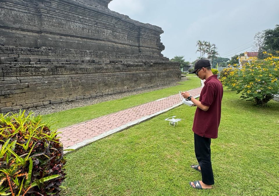
Figure 1. Drone setup
The primary image capture was executed using automated flights with pre-programmed paths to maintain consistency and achieve the necessary 60–80% overlap between images required for photogrammetry. In this specific scenario, the drone was programmed to orbit circularly around the temples, capturing an image every five seconds to ensure unbroken continuity. The specific flight paths utilized for the varying temple layouts are illustrated in Figure 2. During these flights, the drone maintained consistent altitudes for wide structural views and lowered its altitude for detailed shots of carvings and inscriptions, capturing multi-angle perspectives while minimizing shadows and reflections that could distort the reconstruction. Throughout the operation, safety and compliance were prioritized by maintaining a visual line of sight, avoiding restricted zones, and adhering to local altitude regulations.
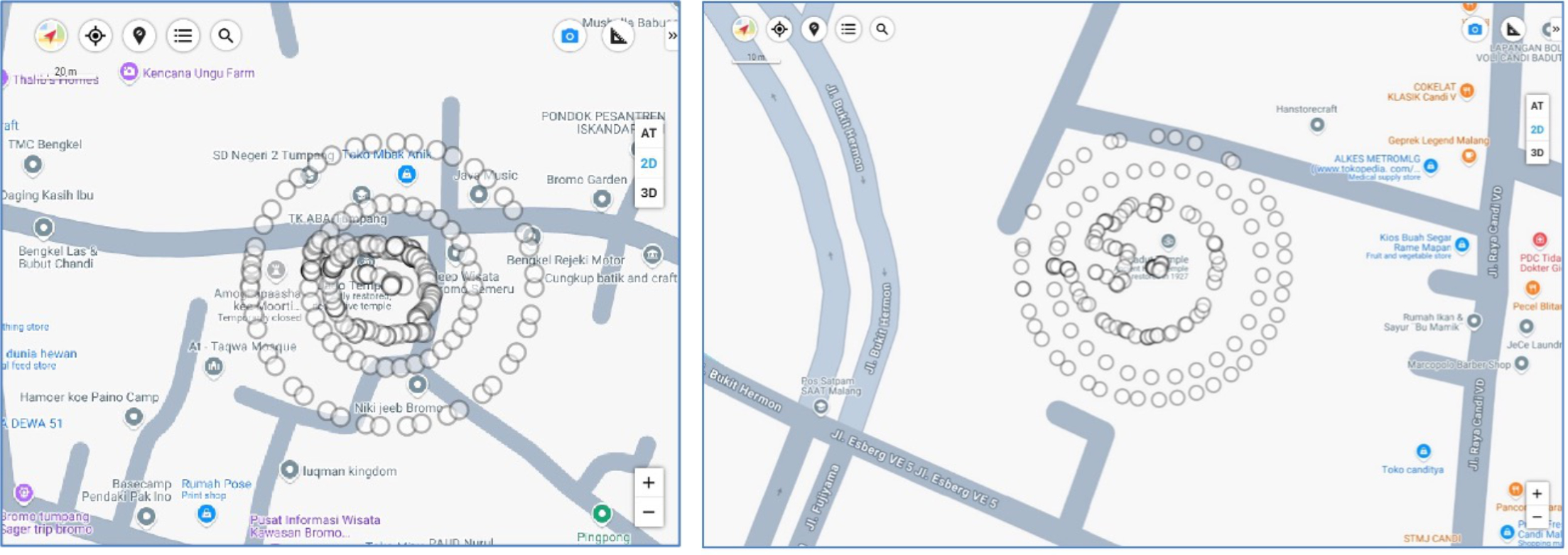
Figure 2. Flight path for data collection
Following the aerial survey, a post-flight data check was conducted on-site to identify any blurred or missing data before backing up the files to secure storage. To address the limitations of aerial capture, specifically regarding intricate textures or shadowed areas inaccessible to the drone, handheld cameras were employed for supplementary data collection. The process of capturing this ground-level imagery is depicted in Figure 3. Finally, all data was prepared for 3D modeling by systematically organizing the files with proper metadata and verifying that the combined aerial and ground-level images met the resolution and overlap standards required for successful processing.
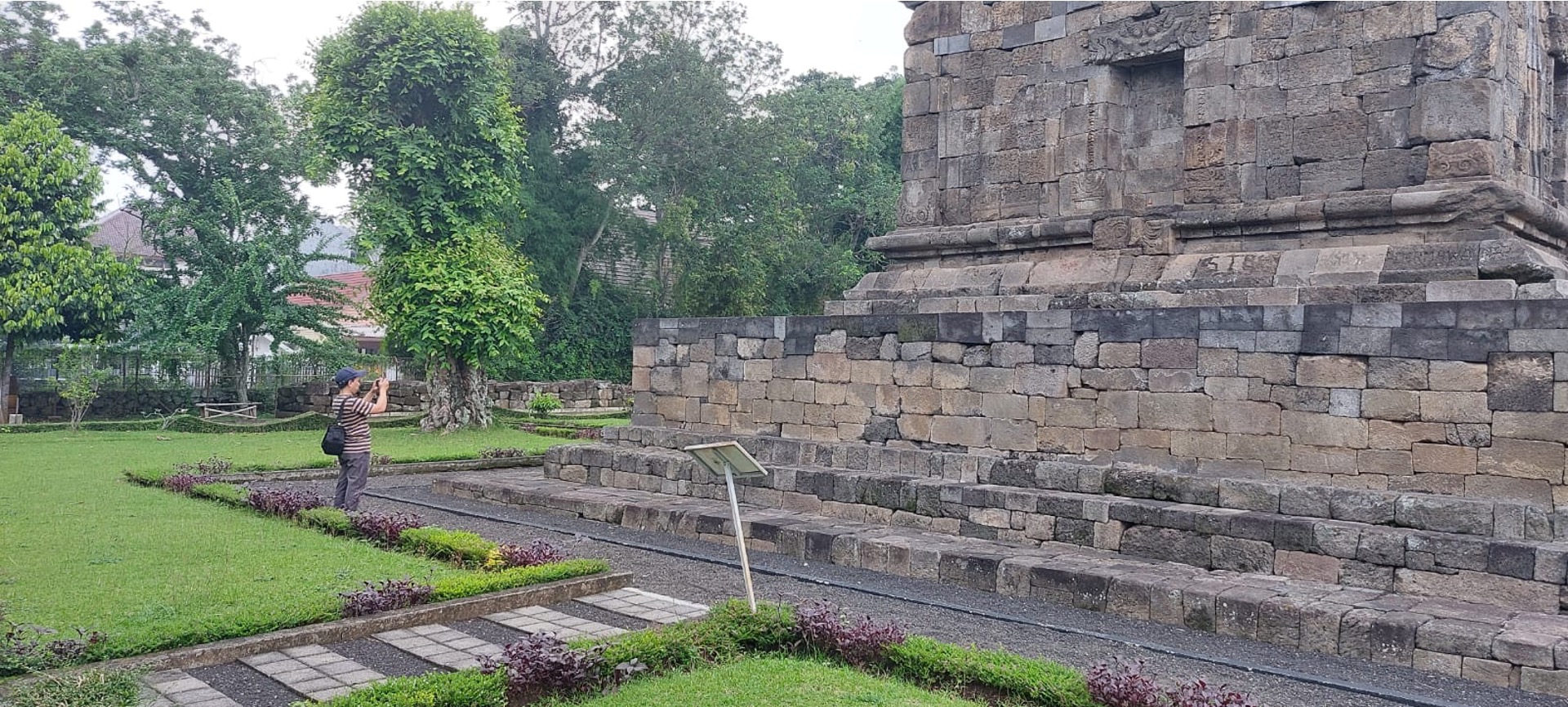
Figure 3. The process of capturing this ground-level imagery